Exploring Earth from the space has been drastically increased and the accuracy of the data is awesome. Thanks to GIS technology, we are currently able to access numerous sources to view the earth through satellite.
I’m really excited to share a blog with you on Satellite maps. If you are a Geography enthusiast or anywhere with mapping related professions like me, you will readily find this post helpful. These 30 maps fall under two categories,
- Satellite Maps
- Thematic Maps
Let’s explore the earth in new ways that you’ve never thought possible!
Satellite Maps
1.Google maps
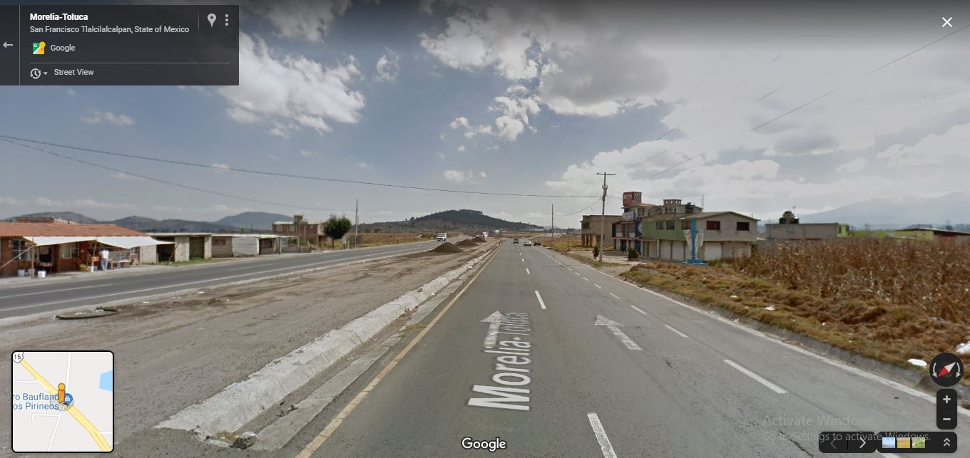
Google Maps provide you to see the earth in various ways such as satellite imagery, Bird’s eye view, Street view, realtime traffic conditions, aerial photography and route planning for transportation by car, air, and foot. It is also used for business listings, Indoor maps and you can create custom maps. Google maps act as a Local guide in our daily life.
2. Google Earth Pro
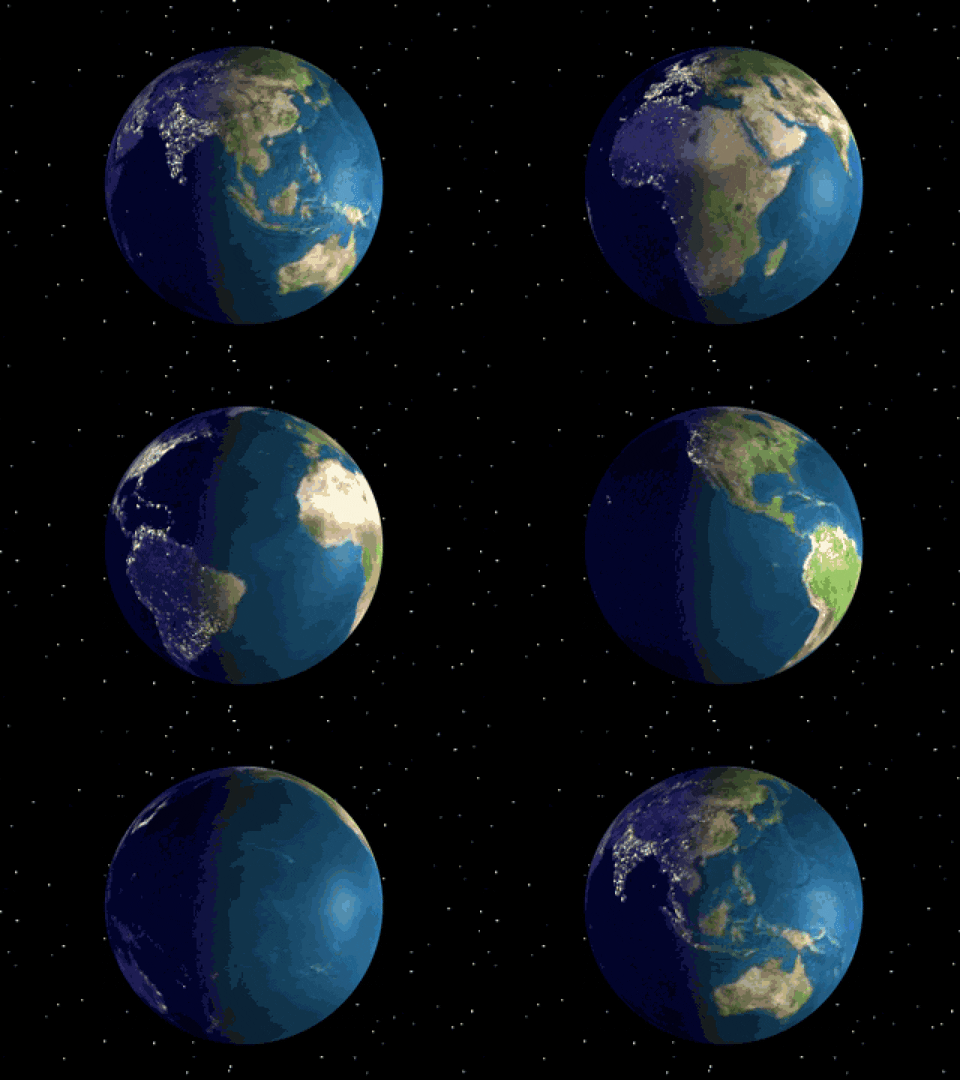
Google Earth Pro is a 3D interactive globe, it flies anywhere in seconds and explores hundreds of cities in 3D right in your browser. You access all the advanced features for free if you are using Google Earth Pro in Desktop. This is used to Import and export GIS data and go back in time with historical imagery.
You can also save the satellite images (only one snapshot at a time on google earth, but some software are available in the market to easily download the group of data from Google Earth Pro. You can also view the 3D buildings and 3D terrain.
3. Mapbox
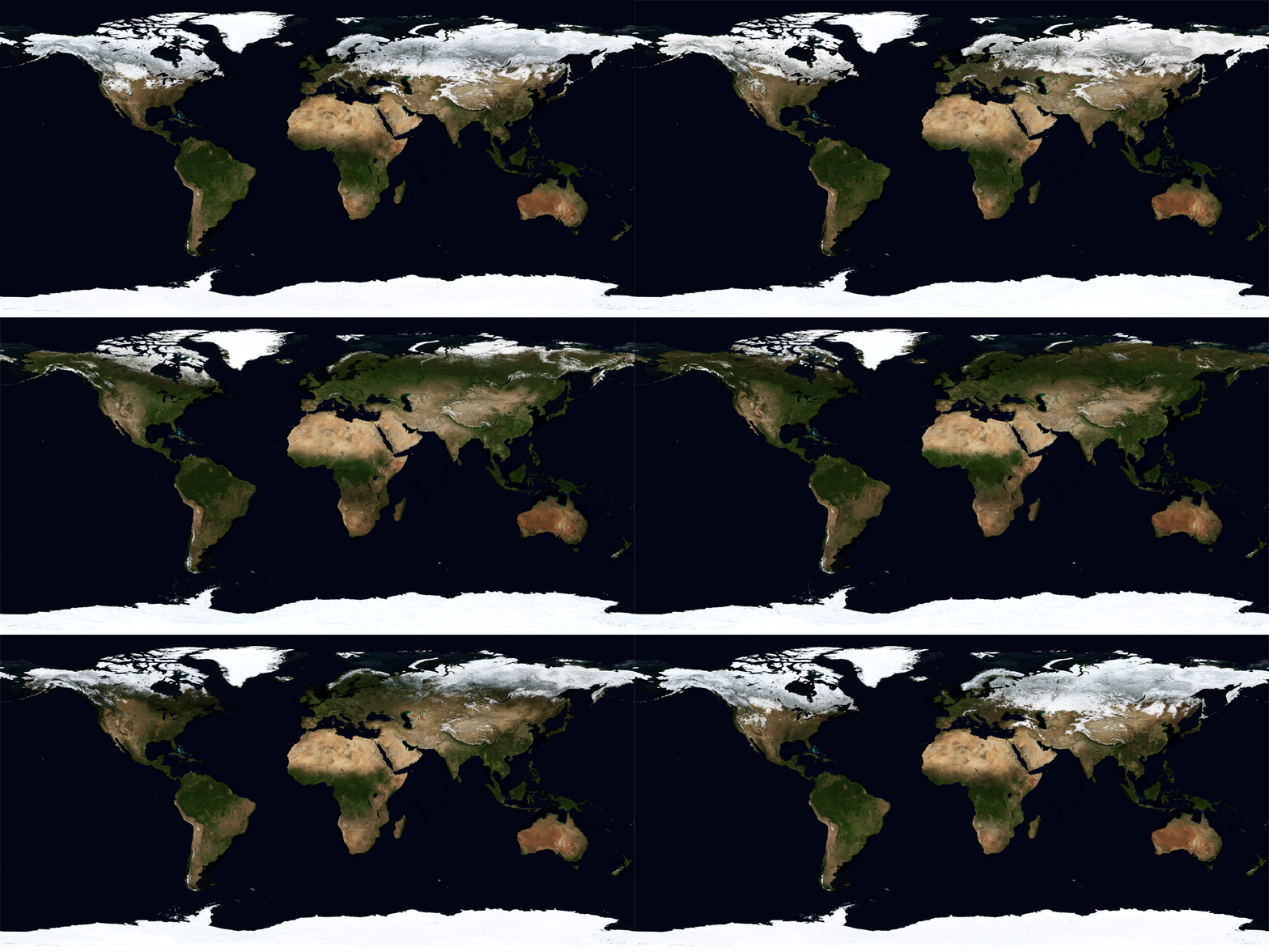
Mapbox is the creator and a significant contributor to the open source mapping. The data are collected from open resources, such as OpenStreetMap and NASA. You can also purchase proprietary data sources to form a commercial vendor like DigitalGlobe.
4. Esri Worldview Imagery
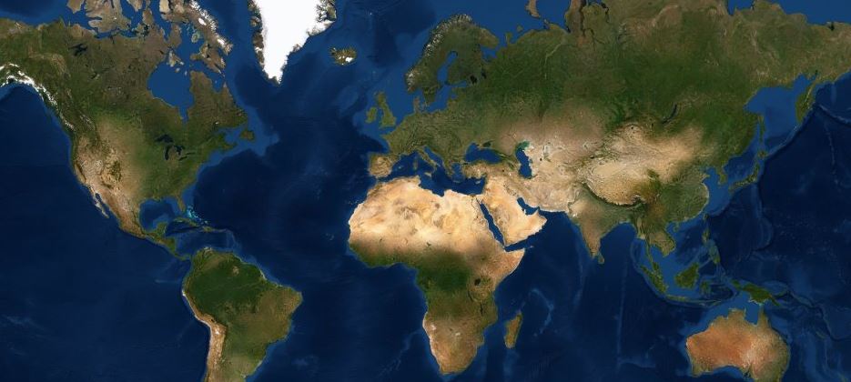
ESRI WorldView Imagery presents satellite imagery for the world. It has high-resolution imagery of the United States and other areas around the world. This map includes NASA Blue Marble. It has next-generation 500m resolution imagery at small scales (above 1:1,000,000), i-cubed 15m eSAT imagery to large scales (down to 1:70,000) for the earth. Anf USGS 15m Landsat imagery for Antarctica.
The map features the imagery of the continental US and western Europe. the imageries are available for other parts of the world at different resolutions. These imageries are contributed by the GIS user community.
5. Bing maps
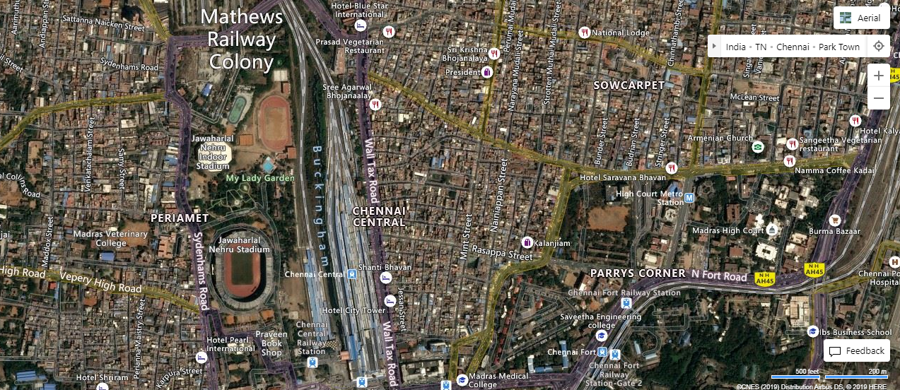
Bing Maps is developed by Microsoft. It offers Satellite imagery, Street maps, Road view, Aerial view, Bird’s-eye view, Streetside, Venue maps,3D maps, Driving, walking, transit directions, traffic information, ClearFlow and more.
6. Here maps
Here Maps is a Technology company that provides location and mapping data. It is commonly used by firms and individuals who own automotive services.
7. Mapquest
MapQuest (stylized as mapquest) is an American free online web mapping service owned by Verizon Media. MapQuest Find Me lets the users automatically find their location, access maps, directions and locate nearby points of interest, such as airports, hotels, restaurants, banks, and ATMs.
Currently, MapQuest uses some of TomTom‘s services for its mapping system. MapQuest provides the extent of street-level detail or driving directions for a variety of countries.
8. Zoom earth
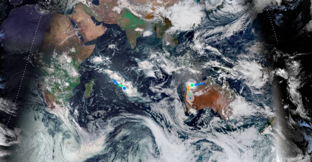
Zoom Earth shows the most recent satellite images and best aerial views with the fast, zoomable maps. You can effortlessly zoom into near-real-time satellite images and historical aerial images of earth. Near real-time satellite images are updated every 10 minutes via GOES and Himawari-8, and every 15 minutes via Meteosat.
Images are produced every day by services from NASA’s GIBS, part of EOSDIS. NASA-NOAA satellite Suomi-NPP, and MODIS. Aqua and Terra provide continuous imagery for “AM” at local 10:30 am, and “PM” at local 1:30 pm. Historical images are provided by Bing Maps and Esri and are updated every few months.It shows cyclone,storms,hurricane,typhoon..etc
9. Yandex
Yandex Search is a web search engine owned by a Russian corporation. It offers facilities such as information, Traffic conditions, street panoramas and photos, Public transport moving in real-time(for specific areas), Parking info and you can create your own customized map, and you will get a detailed transportation network information.
Also Read: Image Classification Techniques in Remote Sensing
10. Rand McNally
Rand McNally is an American technology and publishing company that provides mapping. You can get online driving directions, plan your trips, family vacations and use our travel guides for reviews, videos, and tips.
11. Terra fly
Terra Fly gives high-resolution satellite maps in 3D & 2D view, historical imagery, vector format base map. You can download high-resolution images and it gives some categories of the base map based on resolution, OSM Place name, Environment, and Utilities.
12. NASA Worldview
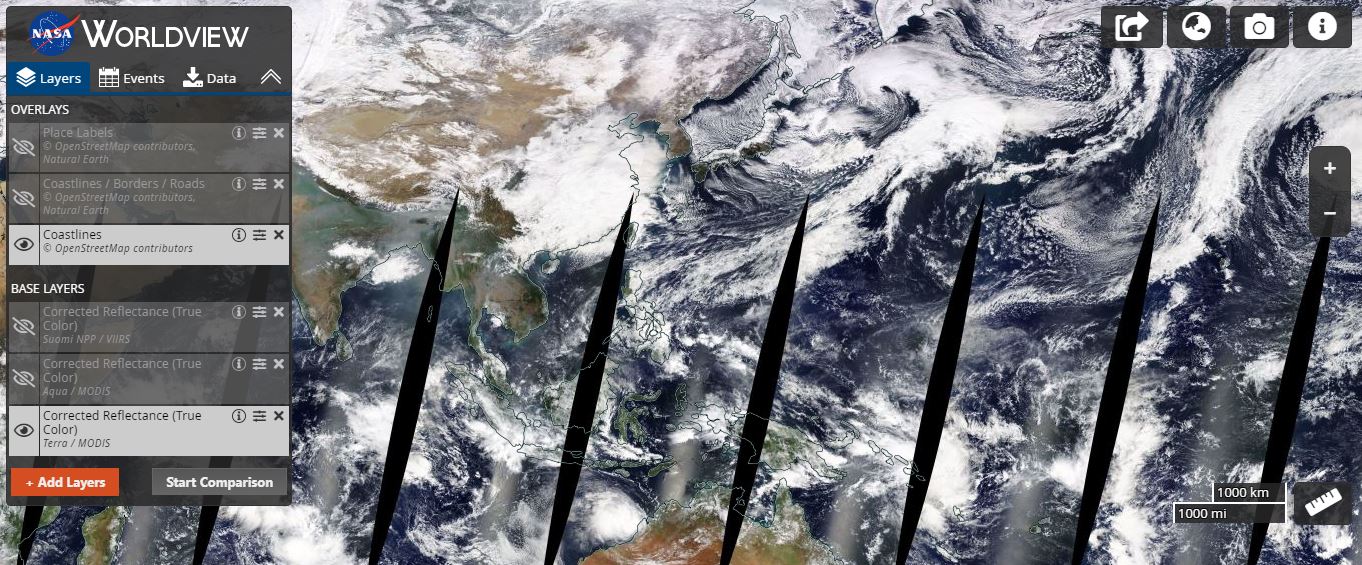
NASA Worldview is an amazing web map service provider. It aims at real-time imagery delivery.It shows over 800 layers of satellite imagery. And typically, most have just a 3-hour delay in time. You can add and view the hazards, disasters, Science Disciplines (Atmosphere, biosphere, human dimension..etc) map layers. It is easy to download data via snapshot and also create changes in map video.
13. Satellite World Map
Satellite World Map gives a high-resolution satellite map for all over the world with facilities information. It also gives temperature, precipitation, Wind speed & direction, atmospheric pressure information in label format. For base map apple map. Google Maps, open street map, Esri map, Yandex map, and map box are contributed.
14. Esri Wayback Atlas
Esri Wayback Atlas is a digital archive, providing users access to the different versions of World Imagery created over time. Each layer in the archive represents a snapshot of the entire World Imagery map, as it existed on the date it was published.
Wayback currently provides access to all published versions of World Imagery, dating back to February 20, 2014. As World Imagery is updated with more current imagery, new versions of the map are published. When and where updates occur, the previous imagery is replaced and is no longer visible. Available versions of the World Imagery map are presented within a timeline as layers in a list.
15.USGS Earth Explorer
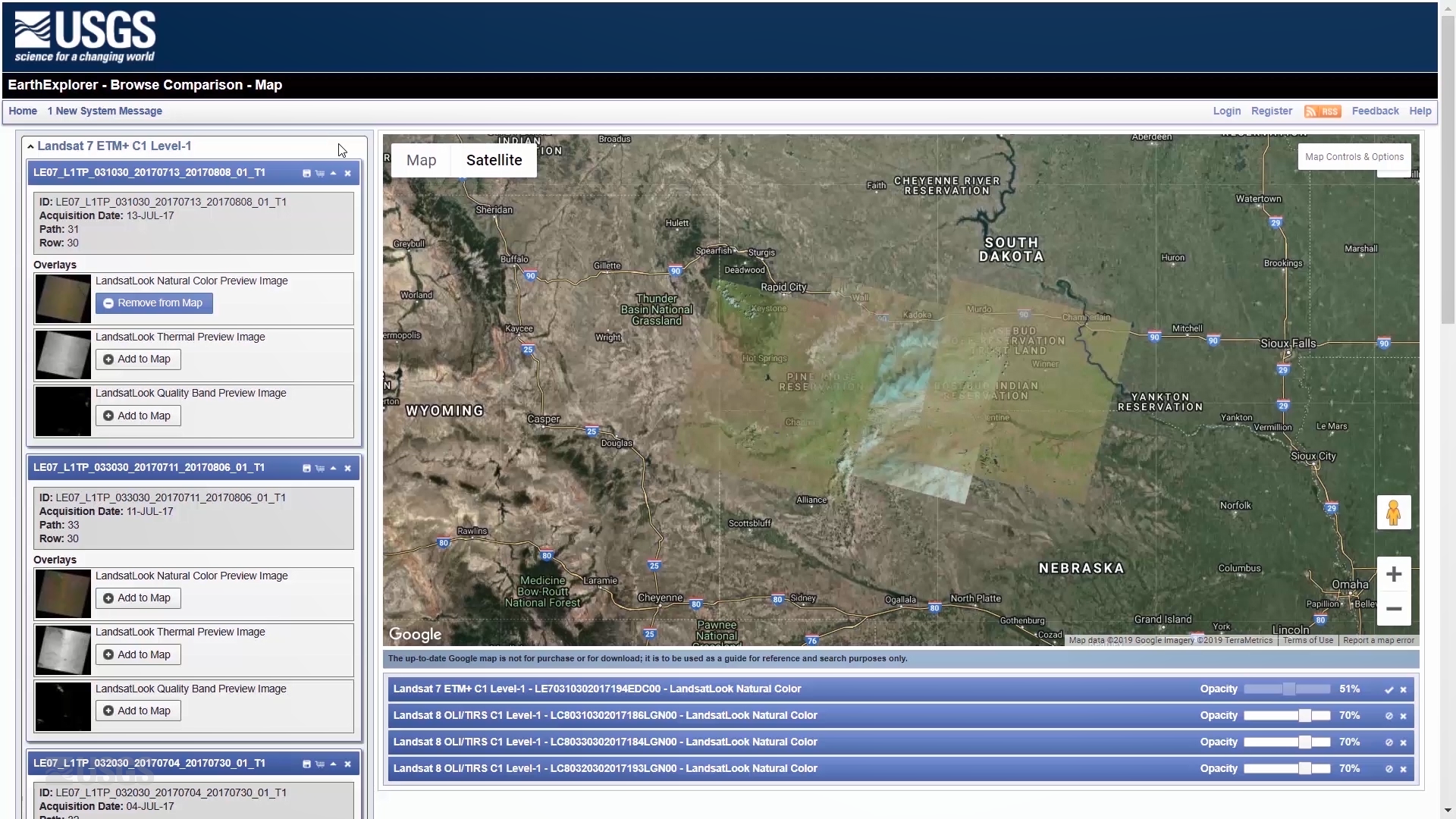
USGS Earth Explorer gives users 45+ satellite platforms to browse through. You can download the satellite images, hyperspectral, thermal, microwave satellite data of the earth. And you can view and overlay the satellite data in web base map, It is very useful in satellite images related studies like mining, land use, land cover estimation..etc
16.Cesium
Cesium is used to create the leading 3D globe and map for static and time-dynamic content. With the best possible performance, precision, visual quality, platform support, community, and ease of use, you can build your own 3D customized map. It is joined by the sentinel, aerial maps, Blue marble, Mapbox, Esri, OSM, etc.
17. Free street view
Free street view is one incredible way to discover the Beauty of Your City. Enter Address or City Name to View Now. Explore India, the United States, Switzerland, and World Online with this easy to use global satellite images.
Thematic satellite maps
18. NOAA Weather Radar
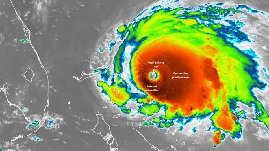
NOAA Weather Satellite Maps tool provides near real-time access to imagery from the GOES-East satellite. You can also get 24 hours of weather information. There are four different map layers,
- Merged geo color map
- World Country Borders
- Infrared Map
- Water Vapour Map
19.NASA’s Fire Information for Resource Management System (FIRMS)
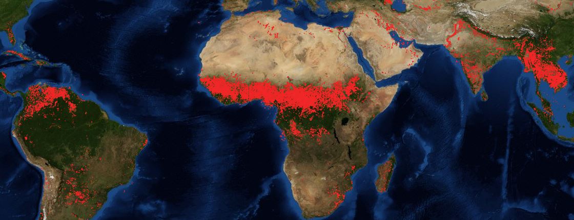
NASA’s Fire Information for Resource Management System (FIRMS) distributes Near Real-Time (NRT), active fire data within 3 hours of satellite observation from NASA’s Moderate Resolution Imaging Spectroradiometer (MODIS) and NASA’s Visible Infrared Imaging Radiometer Suite (VIIRS). Download the forest fire data as in Shapefile, CSV, and JSON file formats.
20. Global Forest Map
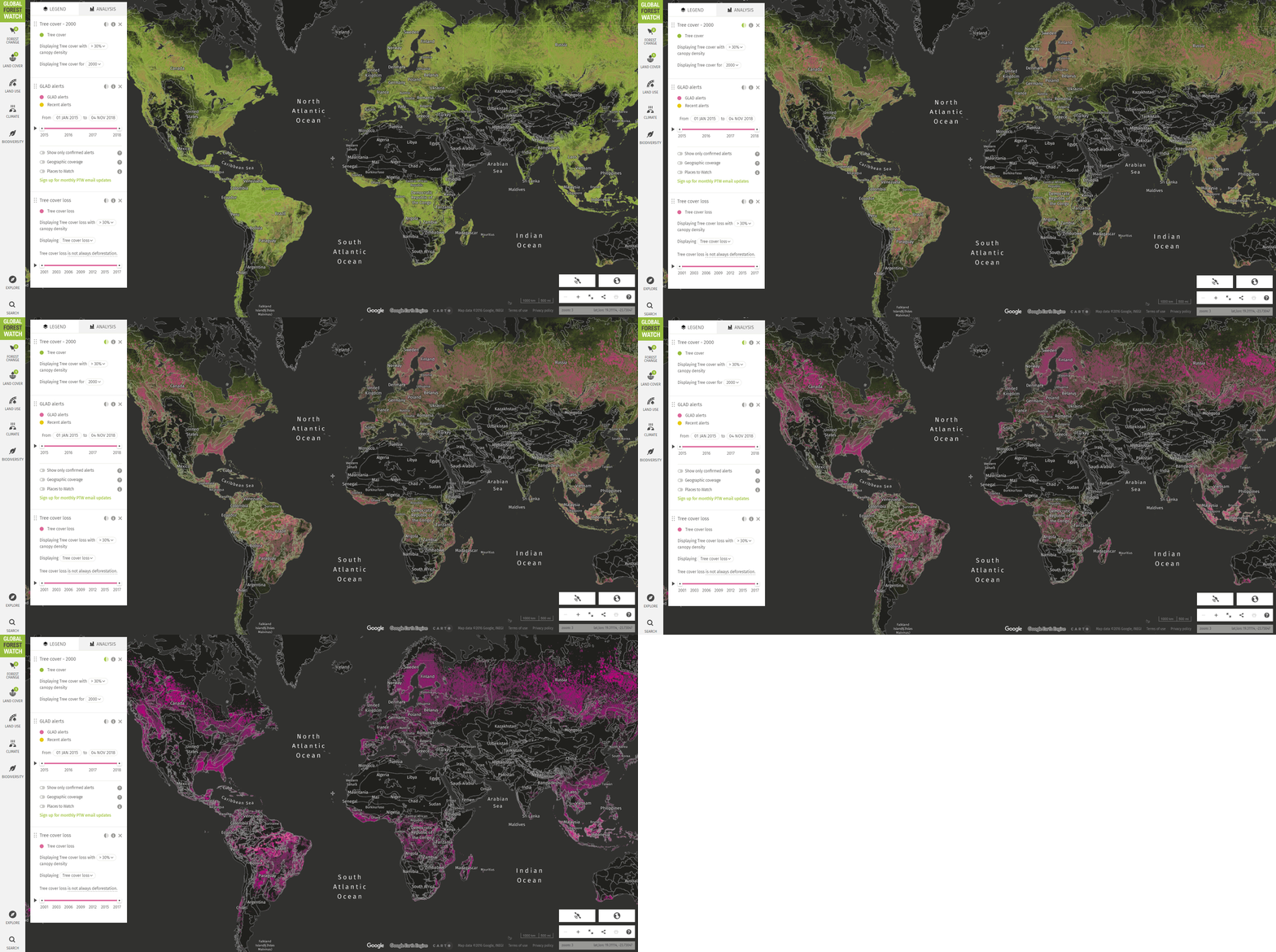
It shows the Global Forest Coverage, which includes forest change, land cover, land use, climate, biodiversity and you can visualize the recent satellite imagery (landsat8 & Sentinel-2 ) with cloud-free. This imagery depicts the natural color and vegetation health from both satellites. The natural color images use information from visible light (red, green and blue) to show Earth’s surface as it would appear to the human eye. Vegetation health is detected using the Normalized Difference Vegetation Index (NDVI).
21.Night View
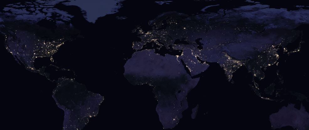
It shows the Night View of the globe with light reflections. It is done by stitching 400+ images from space. NASA has compiled the most comprehensive night view in its black marble map. As seen in this night view map, major cities illuminate the sky the most. Overall, this gives us a ballpark figure for how much humanity has inhabited the land.
22.El Dorado Weather
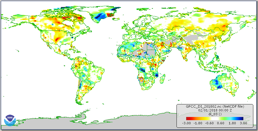
El Dorado Weather gives historical and current weather data using various satellite. Weather data includes rainfall, snowfall, cloud fraction, land surface temperature, sea surface temperature, Water vapor, World Fire, Net Radiation, Vegetation, Carbon Monoxide, Chlorophyll, and Aerosol Optical Depth.
23. NASA Earth observatory
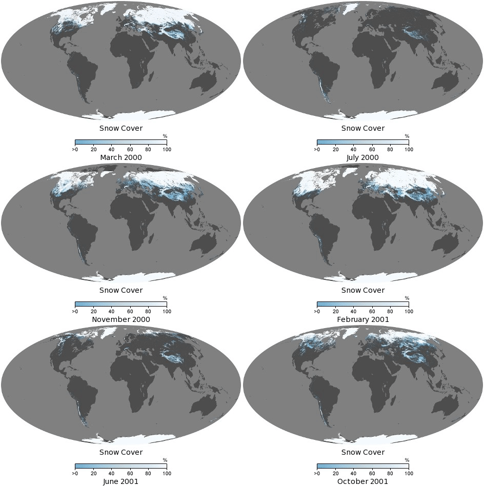
NASA Earth Observatory is a very interesting map site. It has many thematic layers and data are visualized in 2D Map format under 9 categories all over the world. The categories are as follows
- Atmosphere
- Heat
- Humans
- Land
- Life
- Natural Events
- Remote Sensing
- Snow & Ice
- Water
24. Live Map of Satellite Positions
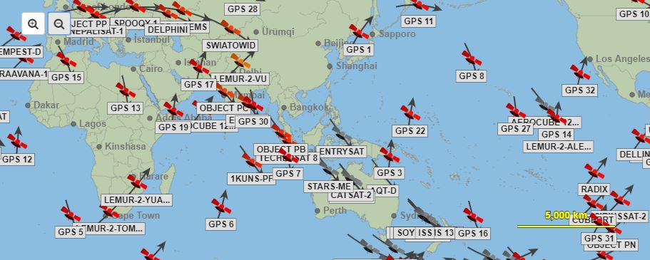
It shows the Live position of all satellites around the earth includes GPS satellites also. It can be visualized in world map satellite position, Satellite in your sky, 3D satellite map, Planetarium of satellites with constellation information.
25. Live Current & Wind Surface
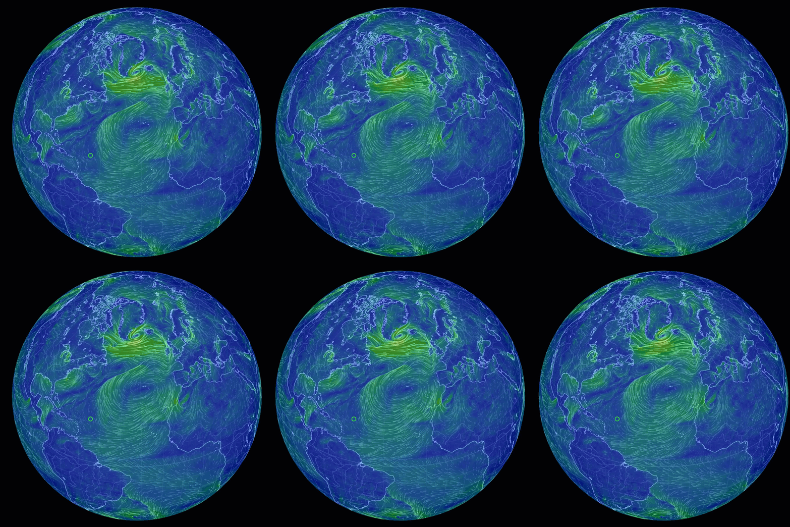
It shows the Live Current and wind surface with speed and inclination, mode, and Height. It is developed by the earth wind map community.
26. Stuff in Space
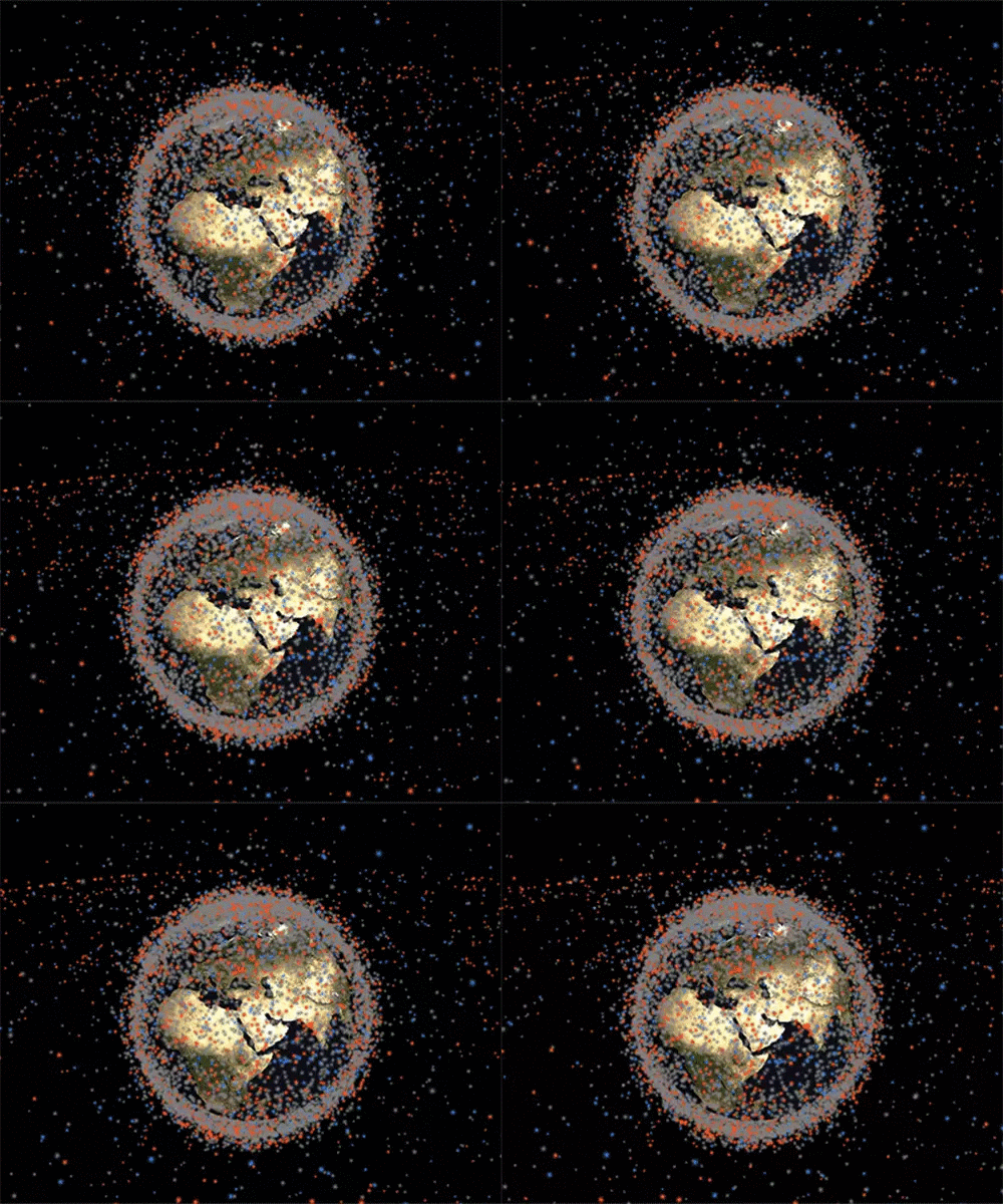
Stuff in Space is a realtime 3D map of objects in Earth orbit, visualized. The website updates daily with orbit data from Space-Track.org
27. Sentinal Cloudless Map
It is a cloudless Multispectral satellite data with historical imagery. You can compare and visualize the changes in a particular location. The major advantage of this website is you can download the sentinel 2 cloud-free data.
Also Read: Geographical Information System (GIS) in Urban Planning
28. Global Land Cover Copernicus
Global Land Cover gives the global land cover information in interactive map format, the main inputs are PROBA-V satellite observations, organized into 45 million Sentinel-2 equivalent tiles of 110x110km.
The base classification follows the UN FAO Land Cover Classification System (LCCS). Compared to the demonstration maps over Africa, even more, details are added to the forest types (now 12 classes), totaling 23 classes.
For all first and second level administrative areas from UN FAO’s Global Administrative Unit Layer (GAUL), that are imaged by PROBA-V, surface area statistics (in km²) are calculated and provided for each class.
29.Timelapse
Google earth engine, It has Lidar, high-resolution DEM, Landsat, Modis & sentinel processed data with specific themes. You can customize by web map using google earth engine. One of the features in the earth engine is google earth timelapse. Earth time-lapse is a global, Zoomable video that lets you see how the earth has changed over the past 35 years.
30.Health Map
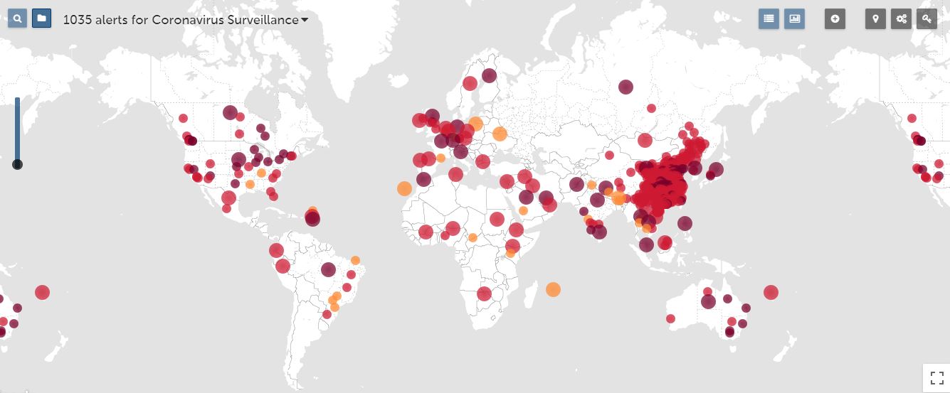
HealthMap is an established global leader in utilizing online informal sources for disease outbreak monitoring and real-time surveillance of emerging public health threats. To achieve an overall view of the infectious disease of the current global state and it’s an effect of human and animal health. It has an automated approach to visualizes and disseminates online information about emerging diseases in nine languages. The ap facilitates early detection of the world’s public health threats.
I hope you find this list useful. I’ve listed the best ways you can explore the earth with these satellite views. Do you have anything to suggest on viewing earth in new ways? Share it in the comment section.
Want to read top content similar to the one you read right now? Get a ride through our insights!
Want more? Then take it yourself. Subscribe for the newsletters which ensure the value you need.


